Sax Rommer's fictional version of Limehouse is fascinating and fires the imagination. It's the perfect setting for any story that requires an abundance of ambiance, excitement, exoticism, and mystery. Occasionally, Rohmer mentions specific locations such as Limehouse Causeway, Three Colt Street, Commercial Road, West India Dock Road, Pennyfields, and High Street.
Naturally, this gives rise to questions concerning geography and the lay of the land. Certainly, it's changed in the last one hundred-plus years. While some streets may still exist, others must have been renamed, rerouted, or vanished altogether. A map of modern Limehouse must look significantly different compared with a map of the area from Rohmer's time, right?
Have you ever wondered what a map Limehouse looked like in Rohmer's time? I certainly have. Fortunately, after a great deal of difficult searching, I was finally able to locate some maps of Limehouse from 1888. That's reasonably close to the period in which Rohmer's stories took place.
On this map, there's a red dot in the lower right. This dot is located on West India Dock Road. Directly east of this dot is Pennyfields and High Street. Directly west of this dot is Limehouse Causeway. Follow Limehouse Causeway further west. It crosses the railroad tracks. Then it intersects with Gill Street. Continue west to the T-intersection. The road running north from that T-intersection is Three Colt Street.
 |
| Left-click to open the image in a new tab. Left-click again to enlarge or right-click to save the image. 16.8MB .jpg file. |
Here's another map of the area from 1888.
Here's another map of the area from 1888-1889.
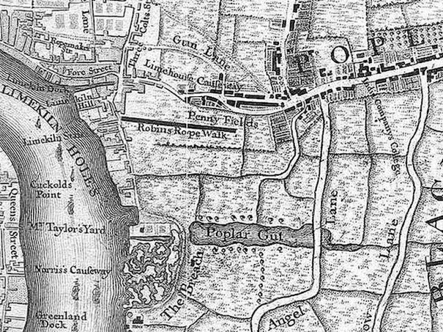
Here's another map of the area from 1745.
Additional Resources
Sax Rohmer's Limehouse
Limehouse: London's Old Chinatown


No comments:
Post a Comment